Thank you for reading my letter and taking the time to come here to look into this further. Below is some more information. Please feel free to contact me with any questions, comments, suggestions, or to inquire on other ways you can help in addition to your contribution to the project.
Background
The Issue: Unsafe Condition of High Rock Acres Road:
High Rock Acres Road starts at Highway 9 and is a two-mile-long, single lane, dirt road, that varies in width from 12’ to 20’ wide, and exists in an assumed 60’ wide right-of-way. Its endpoint is a cul-de-sac and most sections of the road are difficult and dangerous for vehicles to pass each other due to its narrow widths and poor sightlines. The shoulders of the road are washed out in many places, and they’re filled in with overgrown brush which makes sightlines even more dangerous. The road surface is always riddled with countless vehicle-abusing potholes, and constantly develops washboarding and washout on slopes. The erosion of the road surface is a constant reality, and the gravel depth varies and is even nonexistent in most places, leaving only dirt/mud as the road surface.
High Rock Acres Road is considered to be a collector road because it collects the roads of multiple subdivisions and connects them to the Highway 9 thoroughfare. It would therefore be best to be constructed to those standards, and to be publicly maintained by the NCDoT, so that this vital collector road is safe to drive for everyone, and relieves residents from the burdens of ongoing maintenance.
The Problem: Subdivisions and Lot Splits Within High Rock Acres:
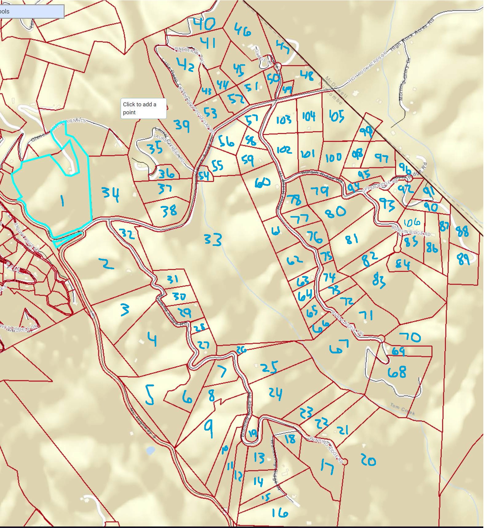
The development generally known as High Rock Acres is a piecemealed, hodgepodge of subdivisions and lot splits, that have flown under the radar of County & State Subdivision ordinances due to their old age and small division sizes. But all of these divisions have added up over the years and have more than tripled the quantity of the original platted lots. All of the land accessed off of High Rock Acres Road adds up to consist of 189 parcels and approximately 111 homes, with plenty of acreage to spare for further unregulated divisions and expansion.
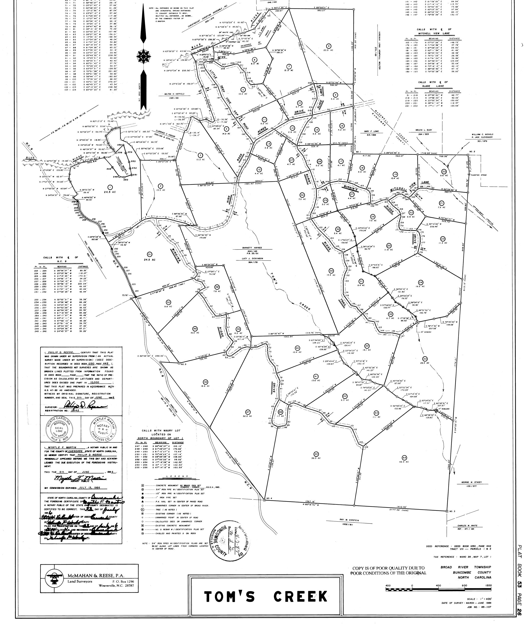
The Counties were approving these lot splits over the years here in the HRA community with no requirement of ensuring the newly created lots had safe access to a public thoroughfare, nor no requirement they weren’t negatively impacting neighboring properties. This was happening because there was either no ordinance with such a requirement in place at the time, or because the lot split was creating less than three new lots, thereby not requiring any oversight by the Counties. For example, the Tom’s Creek subdivision, which is essentially comprised of the properties from Highway 9 to the Buncombe/McDowell County line, started out as a 51 lot development. It currently stands at 108 lots. It more than doubled in size, all with no improvements to the roads, and it can currently continue this expansion forever, with still no regard for the roads, at a rate of up to three lots per lot split.
To draw a contrasting example to that, if a developer was going to take an existing development of 50 lots, and double that density to 100 lots, it would be considered a major subdivision by the County, and would be required to have 20’ wide, two-lane paved collector roads, and 18’ wide, two-lane local roads. The reason for this is because the developer in this example created more than 10 lots and was therefore held to the standards of the ordinance of a major subdivision, which has existed in Buncombe County since c.1994, and McDowell County since c.2007; therefore, the roads would need to be built to the safe standards noted above, per the ordinance. Sounds reasonable to require, right? If you lived in that developer’s development at that time on an existing lot, then I imagine that that would surely have been a requirement of yours too, so that your property value and your safe travel on the roads were not negatively impacted by the addition of these lots. So the major subdivision ordinance would certainly protect, and even increase, your property value, and it would also protect and increase your safe travel on the roads as well.
Yet that never happened here in High Rock Acres because when lot splits happen by different owners, or even by the same owner, at 1-3 new lots at a time, then none of those road improvements are required. The Tom’s Creek development doubled in size just the same as in the developer example above, but there were no improvements made to the roads, and there were no concerns or requirements by the County to make them safe to the same standard as if a developer were to do the same thing all at once. Clearly a drastic difference in requirements. The same is happening on the McDowell County side of High Rock Acres Road, where just a handful of lots morphed into approximately 81 lots that were all created the same way, and all with no regard for the safety of the roads just the same. What’s worse is that zero recorded plats have been able to be found for these lot splits in McDowell County.
So as you can imagine, and hopefully see, the property owners who are not splitting their land, or are unable to split their land (like me), are being negatively affected by the other property owners who have been splitting their land and adding density, burden, and damage to High Rock Acres Road. These lot splits will continue to erode the safety of High Rock Acres Road and will continue to negatively impact property values for everyone. I think we can all agree that that’s not fair. So when is enough, enough?
This is where the High Rock Acres community has fallen into a crack in the ordinances due to the fact that it never had safe roads to begin with, and also due to the fact that there are no ordinances requiring 1-3 lot splits to improve the roads. Obviously you can’t make one property owner pay to pave the roads just so they can split one lot off their property. That would not be fair to them. But conversely, we also can’t stand by while they negatively affect all of the other property owners with their lot splits. So we have to come up with a solution to this problem, and that is what this Proposal is all about. High Rock Acres Road needs to be brought up to current State standards to provide everyone with safe access to Highway 9 before being further burdened with more lot splits.
The Counties never once tried to ensure High Rock Acres Road was safe to travel for the public, or that it was built to current standards and therefore safe to keep adding more burden to it. They just made sure they could still, “get a firetruck down it,” and that is all, and that mentality has not changed. It’s for this reason of lack of oversight that I believe that both Buncombe County and McDowell County need to help facilitate a resolution here, but they won’t do that, so it’s up to us.
Side Roads (also called Local Roads):
The scope of this Proposal is of course only for paving High Rock Acres Road from Highway 9 to the cul-de-sac end. It does not include paving any of the side roads that extend off of it. Property owners that live on the side roads can certainly get together and discuss having their roads (and/or driveways) paved at the same time that HRA Road is paved, to take advantage of cost efficiencies there, but it would of course have to be completely facilitated and paid for by their group. It has to be this way because there are way too many non-conforming, daisy chained side roads to account for them all and many of them may need to stay private if they can’t be brought up to State spec or just don’t qualify based on densities. Neither does everyone want their road paved either so they have to be dealt with on an individual basis by the property owners that use them. With that said, having HRA Road paved is an excellent launchpad to be able to justify paving your own local roads and driveways which will then in turn make your roads much safer, and your properties much more attractive and valuable. A win win for sure.
History of the Road Maintenance Agreement
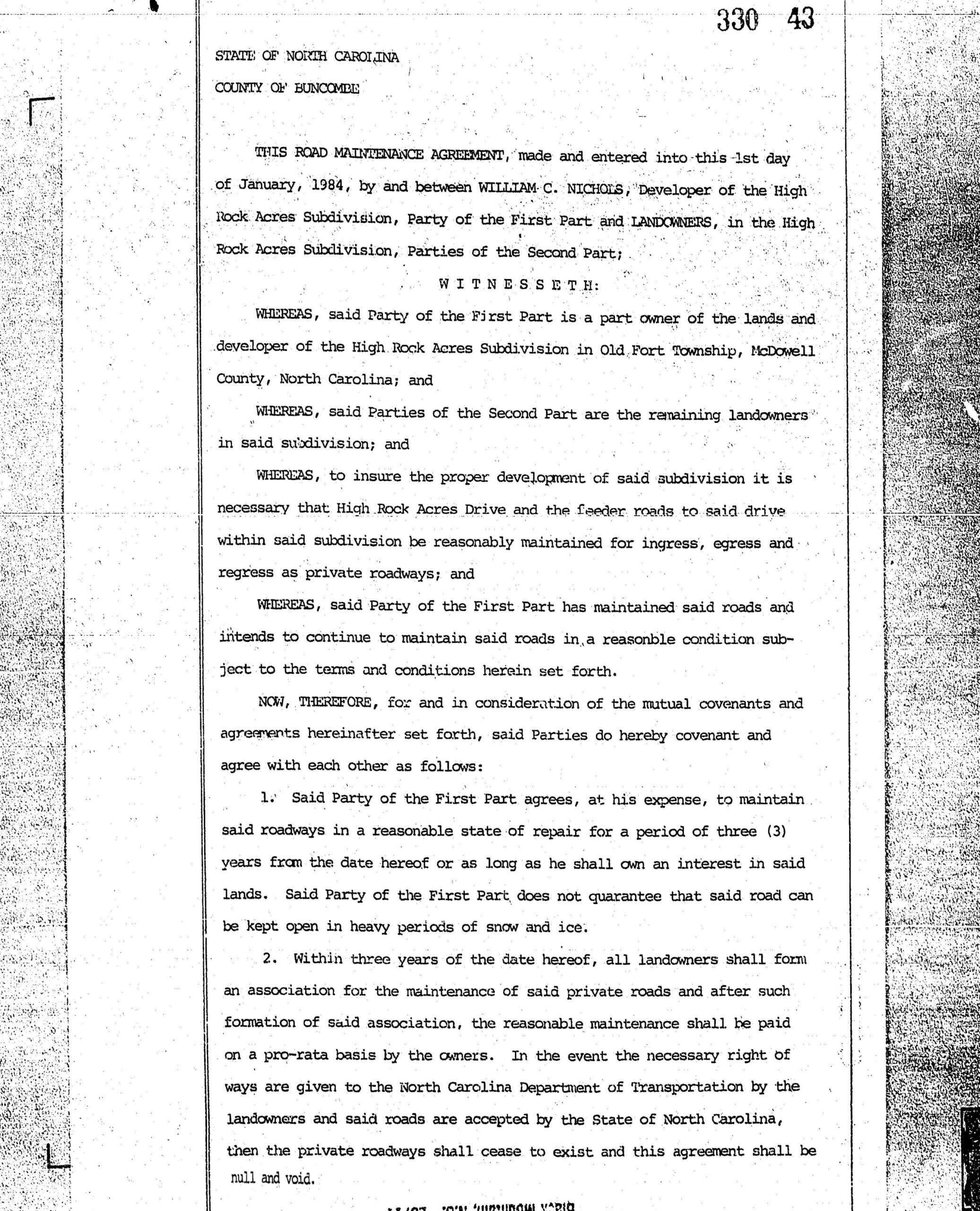
The original 1984 Road Maintenance Agreement, which is no longer in force, was originally established for the roads of the “High Rock Acres Subdivision,” which was only comprised of land to the East of the Tom’s Creek Development. This “HRA Subdivision” land didn’t even touch Highway 9, yet it was the developer of this land, William C. Nichols, that established the only Road Maintenance Agreement in the community, and that his intent was to “reasonably maintain” the roads in the “HRA subdivision,” including HRA Road, but not specifically all the way to Highway 9, as he never specified going outside of the bounds of his “HRA subdivision.”
This “HRA Subdivision,” gained access to Hwy 9 via a Right of Way easement from the Landowner of the land that was later on developed into the Tom’s Creek Subdivision. The Tom’s Creek Subdivision, and the other unnamed subdivisions and lot splits within the HRA community that gain access to Highway 9 via High Rock Acres Road, were never legally brought into the “HRA Subdivision Road Maintenance Agreement”, nor its succeeding unrecorded “Association,” even though they all use the road just the same. Neither did any of them create their own road maintenance agreement, or HOA, to take care of their roads or their section of High Rock Acres Road. All participation by them in the so-called, “Road Maintenance Association,” has been completely voluntary, in addition to it already being completely voluntary for the owners of the land within the original “HRA Subdivision,” being that no legal association was ever formed after the expiration of the original Road Maintenance Agreement, which expired on January 31st 1987.
All that to say this, that there are no legal road maintenance agreements or associations in place for HRA Road, and there is absolutely nobody legally responsible for “reasonably maintaining” it either. This is again where HRA Road has fallen into a crack that keeps it in this no man’s land of disrepair. Since there’s no association formed that has the legal means to enforce the collection of any dues to cover the costs of any real improvements to the road, then nothing can ever happen. Not even a vote by a, “67% majority of a quorum,” of residents at a meeting can change that on their own because they have no legal right to encumber, or financially burden, other property owners’ properties. And this will never change unless there’s a full and legal intervention by the property owners, which will never happen of course. So what is the best solution? To be done with this fake Road Maintenance Association by paving the road and turning it over to the State for them to maintain. The past and current conditions of HRA Road prove that a voluntary maintenance program does not work, and it never will. It will always just scrape by and nothing will change this fact.
The Current Conditions of High Rock Acres Road Prove the Need for Change
Dangerous to Pass Oncoming Traffic:
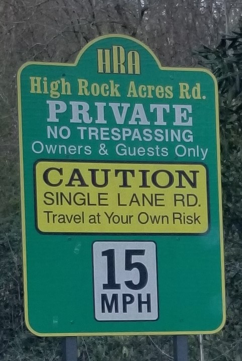
HRA Road is a single lane road. The definition of a single lane road means, a single lane is used for traffic in both directions; when vehicles meet, one must pull off the road to let the other pass.
Not only is a single lane road unsafe and dangerous to have as the main Collector Road of a development, but it’s also unlawful under current County and State Standards. According to the NCDoT Subdivision Roads Minimum Construction Standards Manual, HRA Road is classified as a Residential Collector Road, which is, A road which serves as the connecting street between local residential roads and the thoroughfare system, that should have a minimum road width of 20’, a minimum shoulder width of 6’ on each side of the road, and a maximum grade of 12%. Nowhere in the NCDoT SRMCS Manual is a Collector Road permitted to be a single lane dirt road with 18% grades, and neither is it permitted under County ordinances either, whether public or private. The standard is 20’ wide and paved, with a maximum grade of 12%. So that’s what HRA Rd should be in order to conform with current safety standards. So why should it be left as an unsafe and unlawful single-lane road ripe with possible liability?
In addition to the narrow width of the Road making it dangerous to meet oncoming traffic, the curves, steep 18% grade, and overgrown brush exacerbate that danger. Meeting oncoming traffic at many points of the road forces you into the washed-out shoulders and overgrown brush just to be able to pass. This danger of meeting oncoming traffic is made worse when vision is obstructed by dust, sun blindness, fog, snow, rain, or darkness. Any of these dangers could prove to be fatal if fire, police, or ambulance services cannot reach an emergency in time. And the danger of all of these poor conditions is the worst for pedestrians risking to walk or bike on this single lane road.
Some residents live in High Rock Acres year-round and so the difficulty and danger to travel the Road is obviously many times worse than for residents who don’t live here year-round. This is where we all have to be cognizant of these differences among us, and to be considerate of these facts. We also want to be considerate of the danger and difficulties that non-residents are put in, like guests, delivery drivers, and construction workers who all travel the road every day to bring us our packages and services, yet have no say in mitigating the danger they’re being put in. In short, we should be focused on making the road safe for everyone to travel year-round.
Hazardous Crystalline Silica Dust Exposure:
The current conditions of the gravel/soil road surface is hazardous to the health, safety, and wellbeing of residents because it contains crystalline silica dust that is made extremely airborne with each passing vehicle in dry conditions. Crystalline Silica dust is a known carcinogen. Warnings from local stone quarries have the following statements on their gravel products:


Residents who live directly on HRA Rd are directly affected by the silica dust that cars kick up as they pass. So much dust is kicked up at times, that it coats the surrounding vegetation, homes, and cars, in dust; and this dust is kicked up at any speed. And pedestrians are equally affected by the toxic dust clouds as they breathe in the dust walking on the road. This is again where we all have to be cognizant of these differences among us, and to be considerate of these facts so we can make the road safe for everyone to travel year-round.
Inadequate Road Maintenance:
While they have good intentions, it’s clearly evident that the current HRA Road Maintenance Association does not have the financial or operational capabilities to properly maintain a two-mile-long dirt road. No matter how hard they try in their goodwill efforts, it just never puts a dent in the many deficiencies of the Road. As soon as they run a grading plow over the gravel, it’s torn up or washed out within hours, especially on the big hill.

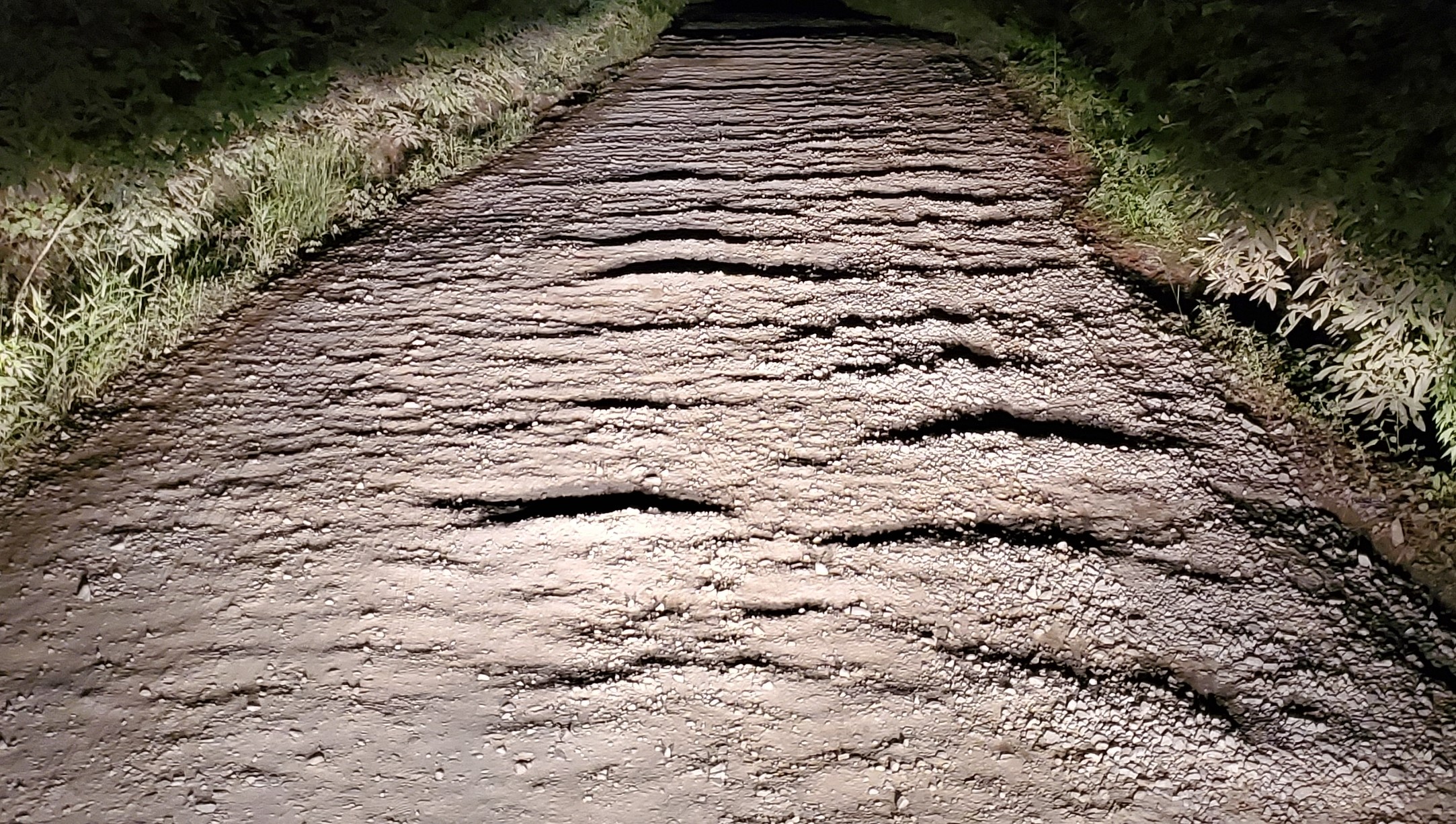
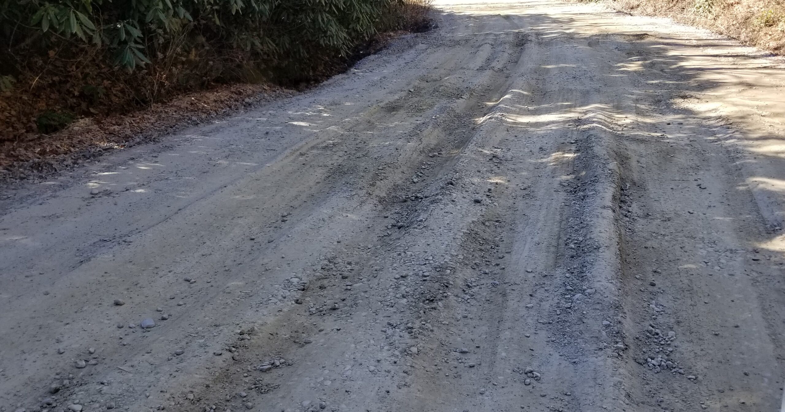
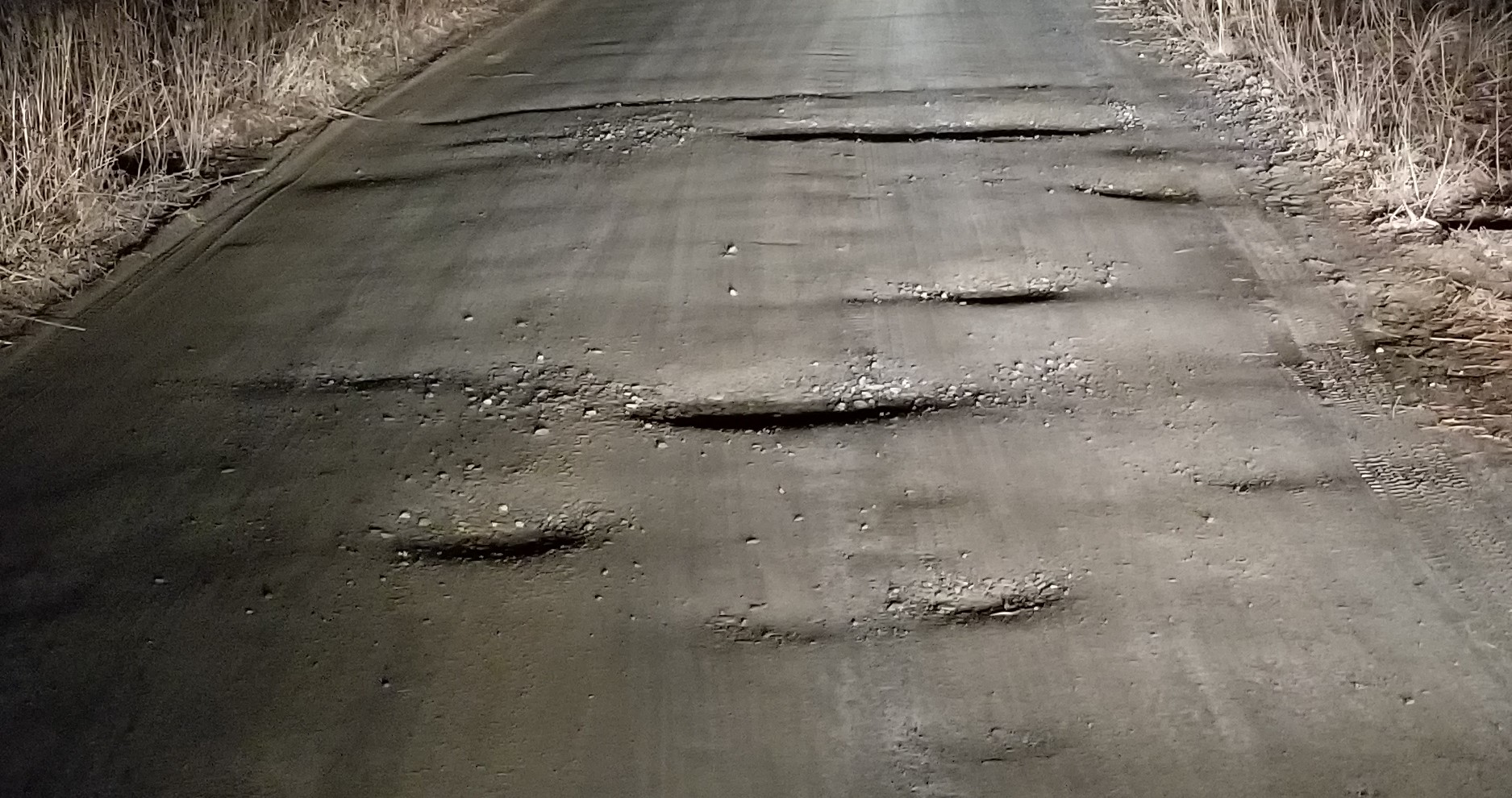
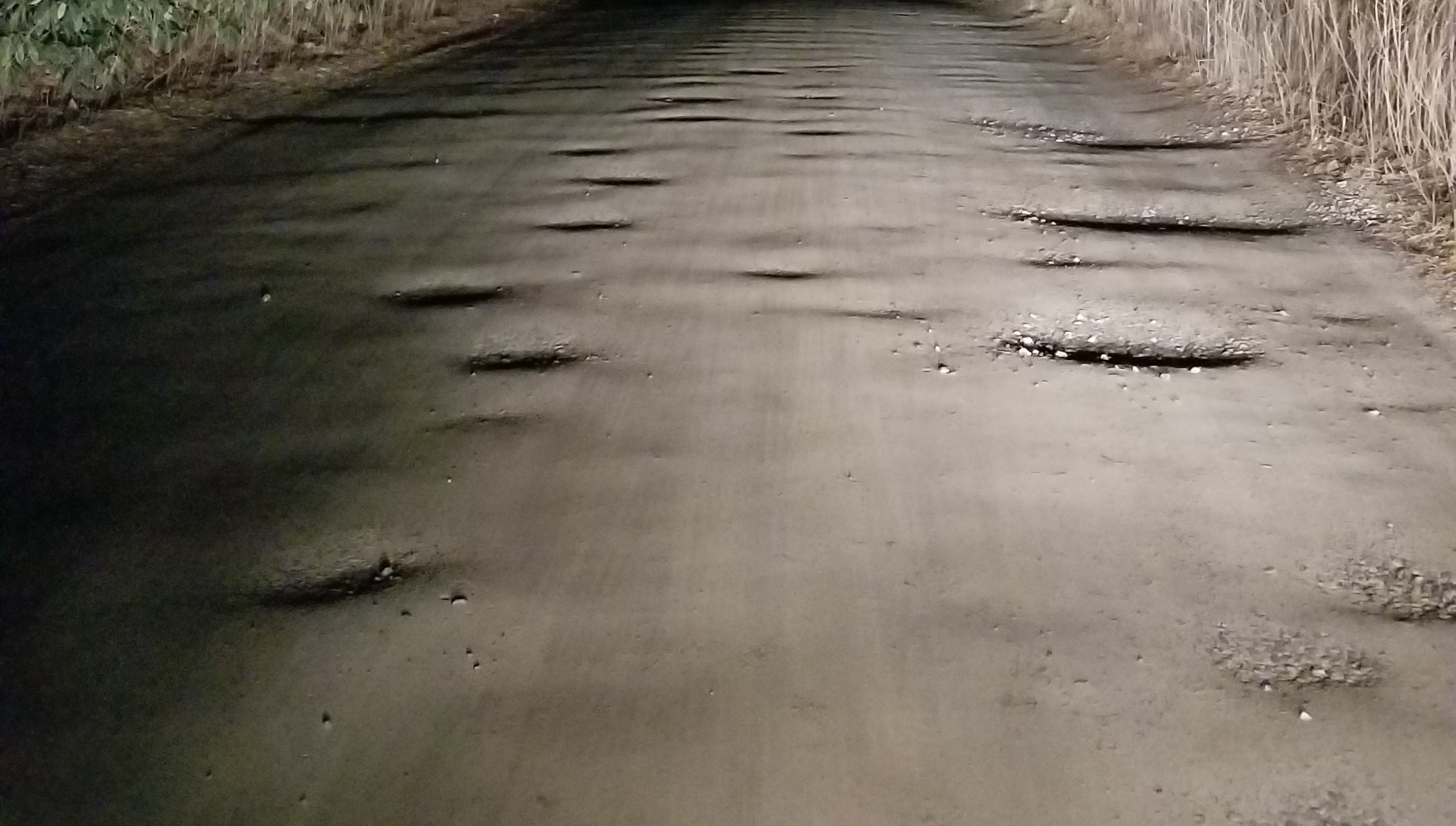
The Road is constantly plagued with potholes, washboarding, erosion washout, and mud. The shoulders of the road have dangerous drop-offs and ravines, and are filled in with overgrown brush that has seemingly never been cut back in most places, even though a 60’ ROW exists to permit such cutting back. The Maintenance Association can never fully mitigate these issues, nor does it even try to come close to mitigating these issues, because as stated previously, it lacks the financial and operational capabilities to do so. Case in point, the entire length of the Road is never graded completely, so the vast majority of potholes and washout are never filled in and only get worse. So the Road is left in a constant state of disrepair and is a constant danger to the health, safety, and wellbeing of residents, and non-residents alike, but most especially for those residents who live directly on the Road. And this will never change unless there’s an intervention by the property owners.
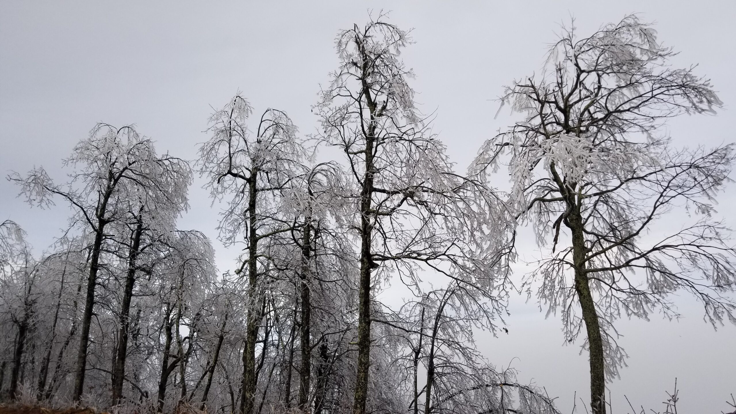
No more is this clearly evidenced than in freezing conditions. Snow and ice on HRA Road makes the Road unquestionably dangerous to travel on, and it can remain dangerous for long periods of time. It can remain dangerous for long periods of time because snow and ice removal on a gravel/dirt road is difficult to accomplish efficiently and completely. The poor condition and steep grades of the Road exacerbates this problem, and then the problem is further exacerbated by the Maintenance Association’s lack of proper equipment that is needed to properly remove snow and ice. This can leave residents trapped for unknown periods of time, and leaves fire, police, and ambulance services out of reach as well during this time, which can of course be catastrophic. This is again where we all have to be cognizant of these differences among us, and to be considerate of these facts so we can make the road safe for everyone to travel year-round.
Road Design & Construction Considerations
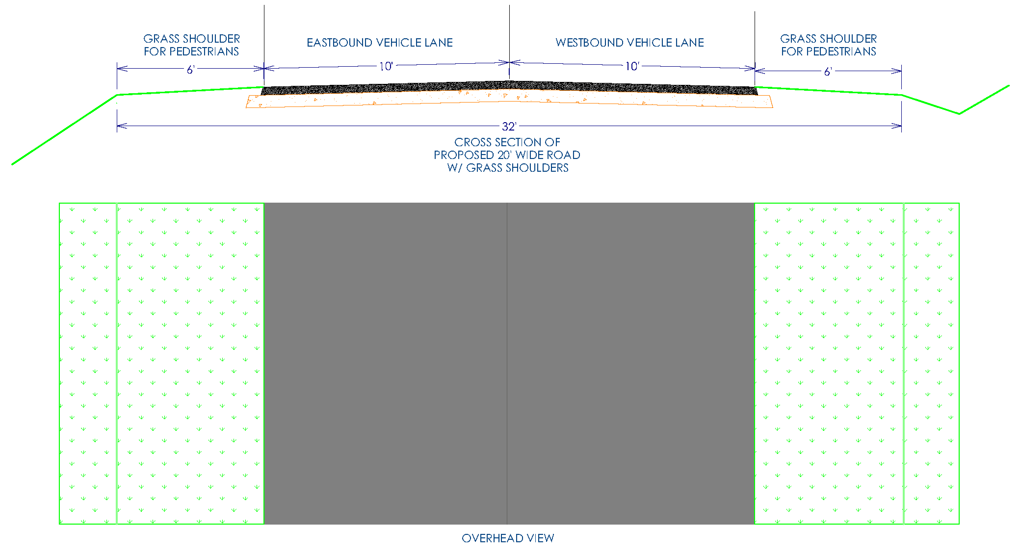
There are certain encroachments into the right of way, such as fences, landscaping, and planted trees, that may need to be removed due to the wider width of the Road. Removal of these items is advised to be done by the property owners, but can of course be done by the Grading Contractor. Any relocation though would have to be done by the property owner at their expense. The goal of this road design should focus on the best construction design for the entire development, and doing that in a cost-efficient manner. Being that the width of the new road would be wider than the current one in virtually every place, most ditch locations will of course have to be relocated within the Right of Way. The focus here will have to be on what exact placement of the road works best for the surrounding grades, and not on what works best to avoid a fence, landscaping feature, or planted tree.
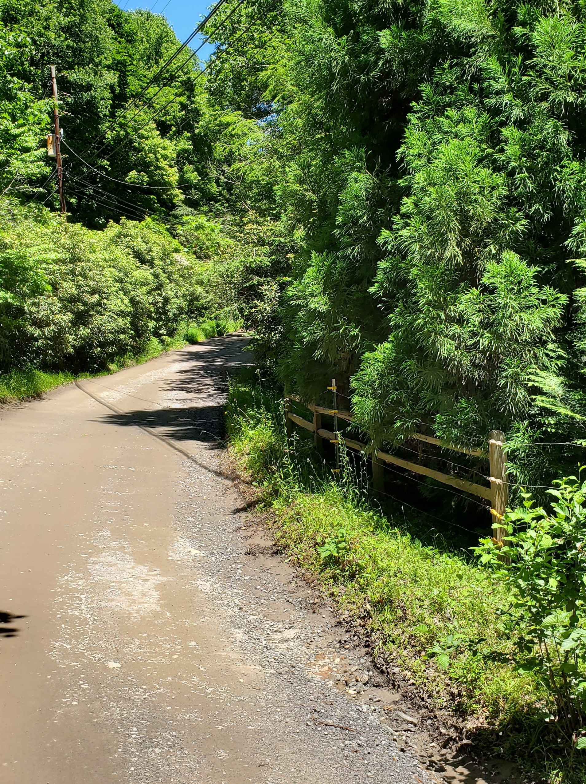
Additionally, there are certain areas where the road will have to shift more to one side than the other within the Right of Way. An example of this is where the road is running directly in front of existing houses that are already built too close to the road under current 35’ minimum setback requirements. We would be obligated per the ordinances to not make that encroachment worse, and so the widening of the road would need to go to the opposite side in these locations.
The engineer will professionally design the means to mitigate and drain the spring water under the big hill. This is not a hard thing to do, all it needs is a sufficient drainage bed with a culvert and/or draintile to a daylight location so it can consistently drain freely.
Driveway Approaches & Local Road Tie-Ins:
All driveways and local road tie-ins will have their approaches to the road changed to some degree in order to match the revised location and elevation of the road. Every driveway and every local road tie-in would have new 18” culverts installed where needed per designed-drainage needs. Approach grades will only be matched back to the existing grade to the extent needed, but not to exceed the boundary line of the 60’ Right of Way, with the exception of the area along the big hill where grading may need to extend past the Right of Way lines as the two driveways in this location will need to be modified due to needing to cut the Road down to 12% grade here.
149 High Rock Acres Drive:
One other driveway that will need to be modified is the driveway found at 149 High Rock Acres Drive. However, unlike the driveways along the big hill, this driveway needs to be modified because it encroaches the roadway. This particular driveway encroaches HRA Road to such a degree that the road surface is only 14’ in width here and has therefore made this particular location of HRA Road even more dangerous for vehicles. The original property owner encroached into the road to make their driveway grade more accessible, and they also raised up the shoulder of the road here in doing so as well. In short, this driveway should have never been put here in the first place.
Once grading is completed in this location and the grades are matched back to existing grade at the 60’ Right of Way line, this driveway will have too steep of an approach angle for their vehicles to climb. It would not be possible to shift the road to the North enough in this location to make this driveway work and so it would be great if this particular property owner would take the initiative to redesign and relocate their driveway on their own accord, out of respect for the community. If they want to continue accessing their driveway off of HRA Road, then their approach will need to be at the Northeast corner of their property and it will have to switchback up their hill to reconnect with their existing driveway. Alternatively, they could ask their neighbors to the West of them if they can get a Right of Way along the south line of their property to access Burnt Ridge Trail, which I think would be the best solution for everyone.
Rerouting of Unsafe Kink West of Dalton Lane:
One of the things that’s going to help the safety of this road a lot, and may also even be required by the State, is to take the kink out of the road to the West of Dalton Lane and reroute it to be as shown below. Removing this kink would substantially improve the safety of the road by making it a flat and smooth curve, and it would make it shorter, be cost effective to do, and could also have other added benefits for the community as well. This hill and kink should be removed because it has tight, blind corners, and the western part of the kink has a steep hill that can put drivers in a dangerous sun blinding position. Additionally, this steep hill can ice over quickly in the winter and stay that way for a while because it’s shaded for virtually the whole day in the winter, causing vehicles to lose control here. All of which also adds up to being a dangerous area for pedestrians as well.
The rerouting of this section would of course require relocating the Right of Way here, and it would be up to the property owner of this land to decide how they’d want to be compensated for that. Hopefully they’d be supportive of it as it would substantially improve the safety of the road. While the additional site work to prep this new route would cost money, I believe that it would be a wash or better because it would save approximately 115 feet of road length, which is about 3,000 square feet of road surface. And the safety improvements this new route makes to the road would of course be immeasurable, and therefore well worth it in my opinion. Here’s a drawing of the proposed route which also shows the proposed 20’ wide paved surface:

Making this change would also provide a great central location in the old roadway to set up a base camp for the construction activities, and also for a place to set up a brush grinding tub. In addition to that, once construction is complete, then the old roadway area could be filled in to provide a nice, open & flat, common grassy area for the community, which could also feature a playground too, if the owners wanted to. Alternatively, this area could be filled in with clean fill and turned into a small lot that would front HRA Road that the owners could do with it as they wish.
On Site Mixed Dirt Disposal:
To save on the cost of trucking, the Project could use a place, or places, to dump mixed dirt. This dirt would mostly be dirt that contains roots and therefore unsuitable for building upon, but it could be used for general fill, such as, widening the shoulder of a driveway, or adding to a yard to flatten it out. So if there were some property owners who could use material like this, then that could save on some trucking costs.
Need for Clean Fill:
There may also be a need for clean fill dirt to widen and raise the roadbed as necessary. We should be able to harvest plenty of clean fill out of cutting the big hill down (depending on where solid rock is of course), but there may still be a need for more. The more local the dirt is, the less expensive the hauling would be, so if there are places within the development where property owners would allow harvesting of clean fill, like to cut down a large hill on their property to create a building pad for example, then that would be a great way for property owners to get some help with their property while helping the Project save money as well.
Right of Way Would Change from Private to Public:
100% of the property owners who abut HRA Road would have to agree to transferring the Right of Way rights that they currently give everyone, over to the State, so that the State can legally maintain it thereafter. These Property Owners all currently give a 30’ Right of Way into their properties from the centerline of the Road (60’ wide total right of way), and that would be reduced down to only giving 25’ to the State, as the State only requires a 50’ wide Right of Way. So this would be an additional win for these property owners.
Costs
Once we’re able to draw up the preliminary plat, we’ll be able to get accurate bids for the work to determine the final cost. As stated in my letter, the total cost of this Project is estimated to be between $1M-1.2M. Also as stated in my letter, there are 189 properties in this development and if every property just paid an equal amount, then that cost is divided down to being only $5,300-6,350 per property (again, if someone needed to finance that amount then it would only be about $35/month).
I realize that all of the properties do not use the full length of the Road equally, and I also realize that the property owners who live off Winding Ridge Road don’t even use all of the big hill. Nevertheless, everyone does need to use the road to some degree to access Highway 9 and so asking for a blanket access fee like a typical development seems to be the best approach because there’s no way to find a perfect formula to factor all of the varying variables of property type, size, location, topography, best use impact, etc. to discern what amounts are appropriate per property. It’s impossible, and all that will lead to is a tit for tat and getting bogged down in bickering about a thousand dollars here or there, and then trying to get people to pay an amount they disagree with, against their will, will be exhausting and a fool’s errand. So the only way to approach getting this road paid for is to ask for everyone to realize and accept that this project needs to happen, that it can only happen if we all help, and that everyone needs to help out as much as they can. At the end of the day, it will only happen if each of you choose to make it happen. Again, honesty and showing gratitude and support is what is needed to get us across the finish line here and bridge any gaps we may have.
Not only will this project have a positive financial impact on everyone’s property, but this road will also have a positive impact on the community as a whole as well, as everyone will be able to walk, bike, and enjoy the road all the same. A two mile long place to walk, and even ride a bike if you’d like, right in your own development, is a great amenity to have. Not only would paving the road bring it up to 21st century safety standards, but it would also bring higher standards back into the development as well that could also spur people to make positive improvements to their own properties as well. All in all, all good things for everyone.
The positive financial impact on each property will of course have the highest impact on the properties who directly front the road, and by varying degrees there even as well. Again, it’s impossible to find a perfect formula to discern what amounts are appropriate to ask from each property. So all I can say to these property owners who front the road is that I would hope that they for sure would all be willing to pledge as much extra as they can to help bridge any gaps we may have, to ensure that we can get across the finish line. Again, showing your gratitude about the positive impact that this project will no doubt have on your own property, and on the community as a whole, by going above and beyond with your contribution is what will be needed to get us across the finish line. If anyone would like to know just how much their property value will improve so they can base their contribution on that, I would suggest talking to a Realtor or an appraiser.
This is a one and done type of deal here and if we can band together to just bite the bullet with honesty and gratitude and make it happen, then this road will finally be safe for everyone to drive and will never again be an issue for property owners in the future. I can only hope that everyone will step up to the plate, like myself, to help out as much as they can. The financing that I mentioned above can help those who want to do their part to help, but can’t pay the whole fee upfront. Anyone looking to do that would be very admirable of you to do and would set a great example to show your support.
At the end of the day, the paving can very easily be paid for if we come together to help out with it. Right now while the economy is slowed down is a great time to get this organized so we can get competitive bids and be ready to start construction before it takes off again. I have done my part to get this going, now it’s up to you to step up to the plate and do yours. As stated in my letter, all that I need you to do right now is to simply shoot me an email or a text to tell me if you support this project, and how much you could put towards it so we have an idea of how much support we have. No money is needed from you right now, all that’s needed from you right now is just to know how much you could put towards it if the project were to happen. Please shoot me an email at dustin@pavehighrock.com with the following info:
I’ll respond to every message I get so if you don’t hear back from me, then please follow up as I must not have gotten your message. Feel free to call if you have questions. Thank you!